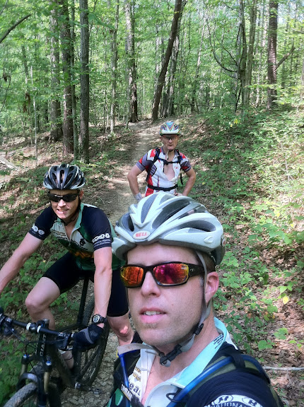
Feeling a bit refreshed from snack time and and after checking my water supply I was feeling a little bit better about not running out too early. We hit the pavement once again just after checking the map ride side up and headed down the road in search of a school, not sure the name of the school but we were fairly positive it was an elementary school. It didn't take us long to find it and thinking back to the directions we were given before we left I recalled our guide telling us to skirt right, around the school and the trail started just behind it. We immediately found a road that skirted right around the school so we followed it assuming we would see the trailhead with ease. Well that wasn't the case but we did see some very interesting yard art. Several cars, some old, some European, some homemade and an old Hamburgular statue from a MacDonald's playground, you remember, from the good ole days. Anyway we didn't see a trail head so we turned around and headed back to the school thinking we might have missed it with all the interesting yard art to gawk at. Once we reached the school it was evident there was no trailhead but there was an abandoned house directly behind the school. Since it was apparent there was no one living there I decided to ride through the yard and circle around behind the house in search of the hidden trailhead. As I cruised through the backyard not really expecting to see anything I found a hole in the shrubs and low and behold there was a trail running behind the property. I wasn't exactly sure we were in the right place but it definitely looked like singletrack so we decided to ride it and see where it went. Worse case scenario we would be riding the wrong singletrack but it was still singletrack so what the hay.
We cruised along wondering aloud whether we were on the right trail or not, but judging from the trail conditions we were, it was in too good of shape and flowed too well not have been built by mountain bikers for mountain bikes.
We stumbled across a downed tree of rather large proportions and knowing it was too large to clear I opted to walk it. Shane decided it was rideable and well.... just watch the video.
I will have to give Shane credit, he did attempt it again and cleared it as did Anthony.
Another mile or so we started noticing some really cool trail markers with a cool chain ring logo of sorts printed on them. We knew then that we were on the right trail just not to sure if we started in the right spot. I just can't imagine a trailhead being located in someone's back yard or at least what used to be someone's backyard. A little further we found a couple of maps attached to trees along the trail which helped us navigate the system a little better.
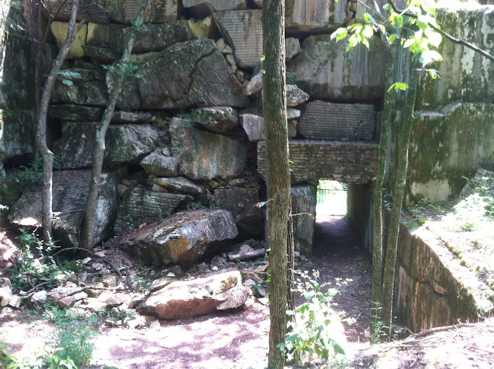
The 3rd trail system from what I can tell is all on private land owned by the head honcho of the Appalachian Mountain Bike Club, evidently he has access to some mechanized equipment, that paired with a nice piece of land has created his own little mountain bike haven that he shares with the public. The wooden structure pictured above was located just a couple hundred yards from his house which thoroughly impressed me. Note to Melinda, I don't care what our next house looks like as long as we have a couple of acres to build our own trails on. Once we had ridden our fair share of the 3rd trail system we decided it might be a good idea to head back before we were out of water and with the amount of wrong turns we had made there was a good chance of a couple more.
We rolled down a gravel road which dumped us onto a paved road all of which were not marked and then Shane announced we were to turn left back onto another graveled road. After a few minutes of this I began to question him since nothing was marked and how was he so sure about this specific turn. Shane rambled on in a way that only Shane can and he did make a very convincing point but before he could finish the road ended. I laughed nervously as Shane added another beer to the first one he promised to buy me for leading us astray. As we back tracked he found another turn and decided to follow it. Anthony and I decided to wait as it didn't look like much but surprisingly he found singletrack. Still no markings but it was singletrack so we rode it, how Shane found it and figured out which way to go I'll never know. It was either shear luck or maybe my guardian angle was whispering in his ear.
This singletrack was obviously not built by mountain bikers as it went straight up and down the steepest sections of the hills but we found the river we that was pictured on our map so knew we were headed in the right direction and we finally ran into another rider who confirmed we were on the right path. About another mile of billygoat style singletrack and we dumped out onto a paved greenbelt and simultaneously my Camelbak ran dry. I was never so glad to see a paved path while riding my mountain bike. Out of water and legs made of toast I was ready to find the car and refuel.
Shane announced that he felt he had redeemed himself and took back one of the beers he promised me, I agreed and looked for a tow rope to attach to his handlebars. Anthony and I were ready to get back to some water but Shane felt the need to keep stopping for stretching, gels and bird watching.
Once we finally reached the car I grabbed my extra water bottle I had left in the car, hot water never tasted so good. We made our way home but not without stopped for beer and pizza, I highly recommend the Tomato Head and it has nothing to do with the fact that there is a Marble Slab Creamery right next door.


